top of page


What's new? July 2026 - Forest Financials
This month we gave you the full financial picture for your forests: NPV, IRR and payback period, right alongside your carbon revenue projections. We also shipped Custom Tasks, so you can build your own workflows instead of working from predefined ones, plus a nice bit of magic where you can now see collaborators' cursors moving live on the map. A few useful fixes rounded out the month too.


What's new? June 2026 - Multi-Rotation Forest Planning
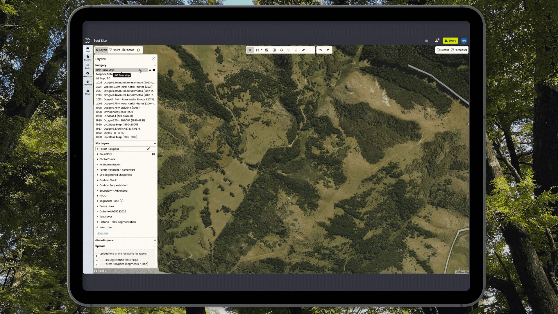
Forests have histories. They get planted, cleared, and replanted - and now the platform can hold that full story. This month we've added support for multiple planting and clearance events per polygon, plus a refreshed layers panel with transparency controls, expandable charts, and a handful of other useful improvements.


Your land transition opportunities, with zero clicks
Most farmers have a paddock or two that doesn't quite pull its weight. Too steep, too scrubby, too slow to recover after a dry spell. CarbonCrop can now tell you what it could be doing - without paying someone to confirm what you already suspected.

What's new? May 2026 - Company Layers and Forest Planning
April brought a genuinely new platform capability, the next chapter in forest planning, and a batch of usability improvements that add up to a noticeably smoother experience. Company Layers, Paste to Split, staged forest events, ten credit schemes, and more.


What's new? April 2026 - ETS Pathways Tab
This month we shipped a new ETS Pathways tab in Analytics - a dedicated place to see your ETS registration options clearly, with the numbers to back them up. Plus a new Transfer NZUs task, show/hide Done tasks, and a raft of bug fixes.


What's new? March 2026 - Comments on the Map
Pinned comments are now available to all users - you can pin a comment to draw attention to something specific on the map, and all comment types now show up in the comments summary panel. Plus address search on the sites map, editable invoice dates, and a solid round of bug fixes.


What's new? February 2026 - Better Platform Usability
The focus this month was better platform usability improvements, so we have lots and lots of small but powerful changes.


What's new? December 2025 - Ready to Register Under the New ETS Legislation
This month was all about making sure forests could be registered under the new ETS restrictions.
What's new? November 2025 - AI for Pre-90 Forest
This month we removed the some of the ambiguity of forest in historical imagery with the release of a new AI model that detects forest in greyscale imagery.


What's new? October 2025 - Polygon Colours and Scrub
This month was full of visual tools to put the AI land cover data at your fingertips (and your eyes), and practical tools to make planning easier.
CarbonCrop's Tech Updates
What's new? July 2026 - Forest Financials
This month we gave you the full financial picture for your forests: NPV, IRR and payback period, right alongside your carbon revenue projections. We also shipped Custom Tasks, so you can build your own workflows instead of working from predefined ones, plus a nice bit of magic where you can now see collaborators' cursors moving live on the map. A few useful fixes rounded out the month too.
What's new? June 2026 - Multi-Rotation Forest Planning
Forests have histories. They get planted, cleared, and replanted - and now the platform can hold that full story. This month we've added support for multiple planting and clearance events per polygon, plus a refreshed layers panel with transparency controls, expandable charts, and a handful of other useful improvements.
Your land transition opportunities, with zero clicks
Most farmers have a paddock or two that doesn't quite pull its weight. Too steep, too scrubby, too slow to recover after a dry spell. CarbonCrop can now tell you what it could be doing - without paying someone to confirm what you already suspected.
bottom of page